


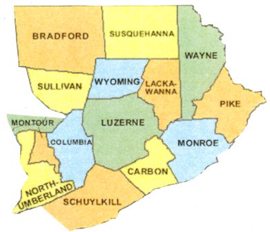
County guides for the 14 counties of Northeast Pennsylvania: Bradford, Carbon, Columbia, Lackawanna, Luzerne, Monroe, Montour, Northumberland, Pike, Schuylkill, Sullivan, Susquehanna, Wayne, and Wyoming.
HISTORY
Like much of Pennsylvania, this region was inhabited originally by Indigenous peoples. The Lenapehoking lived in what is now Scranton and its environs. In the late 18th century, Europeans who had settled in New England started moving into this area, establishing small businesses and mills. The first village was called Slocum Hollow, and in 1778, Isaac Tripp was its first European settler.
Northumberland was formed in 1772 from Bedford, Berks, Cumberland, Lancaster, and Northampton counties; in 1786, Luzerne County was formed from part of Northumberland, and in 1798, Wayne County was formed from part of Northampton County. In 1810, Bradford County was carved from Luzerne and Lycoming counties, and Susquehanna from Luzerne County. The following year Schuylkill County was created from parts of Berks and Northampton counties. Columbia County was formed from Northumberland in 1813, and Pike followed in 1814 from Wayne County.
Over 20 years later, Monroe County was formed from Northampton and Pike counties. In 1842, Wyoming County was formed from Luzerne County, followed in 1843 by Carbon, formed from Monroe and Northampton counties. Sullivan County was carved from Lycoming County a few years later, in 1847; then Montour was formed from Columbia County in 1850. Finally, in 1878, Lackawanna (the last of Pennsylvania’s 67 counties) was formed from Luzerne County.
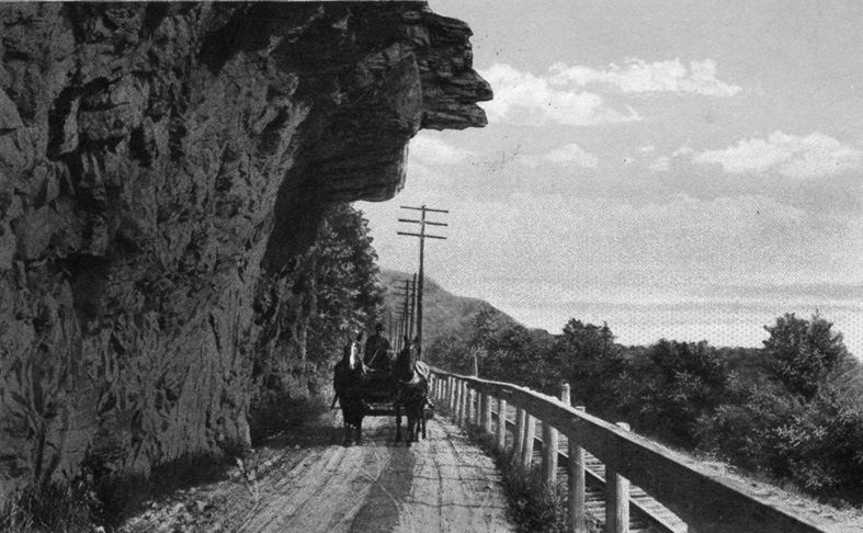
The region encompasses the Pocono Mountains, the Endless Mountain, the Wyoming Valley, and the Coal Region. The Wyoming Valley, a crescent-shaped depression that is part of the Appalachian mountain range, is also known as the Scranton/Wilkes-Barre area, after its principal cities, Scranton and Wilkes-Barre. The Susquehanna River flows in the southern part of the valley, which is notable for its deposits of anthracite coal, discovered in 1762.
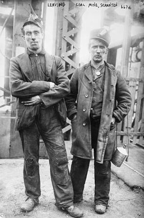
The so-called “coal region” encompasses Carbon, Columbia, Lackawanna, Luzerne, Northumberland, Schuylkill, and northeastern Dauphin counties. Scranton was the center of the anthracite coal industry – the largest known deposit in America was being mined in this region, from Carbondale to the north to Wilkes-Barre to the south. In the late 1800s and early 1900s, hundreds of thousands of immigrants arrived to work the mines, transforming the Wyoming Valley from a farming area to a metropolitan area. So-called “patch towns” emerged, which were like small villages associated with – and owned by – individual mines and populated by miners.
Railroads proved the best way to transport coal and soon became prevalent in this region. In 1851, the Delaware, Lackawanna and Western Railroad (DL&W) was founded to transport iron and coal products from the Lackawanna valley, and the Pennsylvania Coal Company built a gravity railroad, which is a railroad built on a slope so the cars can coast downhill by the force of gravity alone. The Delaware and Hudson (D&H) Canal Company also built a gravity railroad, as well as a steam railroad to Scranton in 1863.
By 1890, three other railroads – the Erie Railroad, the Central Railroad of New Jersey and finally the New York, Ontario and Western Railway (NYO&W) – had built lines, tapping into the rich supply of coal.
GSP welcomes your suggestions, knowledge and guidance to genealogical resources within any area of Pennsylvania in which you live and do your own research. If you have information to share about local societies or repository resources, historical knowledge of the local area, or any other relevant genealogical information that could help people find their ancestors, please contact GSP so we can add this information to the County page. Thank you!
Thank you to Jane Benner for her contribution to this page!
Northeast Pennsylvania map image courtesy of www.digital-topo-maps.com
Photo Credits:
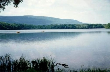
Center right: Camelback Mountain (Big Pocono) from Mt. Spring Lake, Photogrpaher Joe Calzarett, Wikimedia Commons
Bottom left: Miners leaving coal mine near Scranton, PA. Library of Coungress, Photo ID – LC-DIG-ggbain-03206)
