


County guides for the 12 counties of South Central Pennsylvania: Adams, Bedford, Blair, Cumberland, Dauphin, Franklin, Fulton, Huntingdon, Juniata, Mifflin, Perry, York
SOUTH CENTRAL PENNSYLVANIA
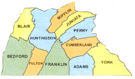
This region comprises 12 counties: York, which was formed in 1749 from Lancaster County; in 1750, Cumberland County also was formed primarily from Lancaster County. Over 20 years later, in 1771, Bedford County was carved from Cumberland, as was Franklin County in 1784. Dauphin County was formed from part of Lancaster County in 1785, then Huntingdon County from Bedford County in 1787. In 1789, Mifflin County was formed from Cumberland and Northumberland counties, and in 1800, Adams County was carved from York County. The other four counties were formed over the next 50 years: Perry in 1820 from Cumberland; Juniata in 1831 from Mifflin; Blair in 1846 from Bedford and Huntingdon counties; and Fulton in 1850 from Bedford.
Several of the counties in this region – Adams, Cumberland, Dauphin, Franklin, and York counties – are part of the Piedmont plateau, a heavily agricultural region that stretches between the Atlantic Coastal Plain and the Appalachian Mountains. These counties, along with Perry County, also are considered Pennsylvania Dutch Country, an area with a lot of German Amish, Mennonite, and “Fancy Dutch” inhabitants, and where Pennsylvania German was the common language.
Cumberland and Franklin counties lie within the immense Cumberland Valley, bordered by the Blue Ridge Mountains on the north and South Mountain on the south. Settlers first arrived in the Cumberland Valley between 1725 and 1727; there was no treaty with the native Indians at that time, and the settlers were terribly harassed: in 1755, the population of 3,000 dropped to about 300. It was almost 10 years later, when a treaty was signed, that settlers returned. The majority of those who came at this time were Scots-Irish – Dauphin County, for example, is the home of many pre-Revolutionary Presbyterian churches. Germans migrated here too – many of them were Mennonites.
With its rich farmland, agriculture is the primary industry in this region, but there are also extensive mineral and manufacturing resources. Mills always abounded – grist, flour, lumber, and woolen – as have tanneries and iron furnaces and forges. For example, in 1760, the Carlisle Iron Works Furnace was built; cannons made there were used during the Revolutionary War. There are immense quantities of limestone and iron ore in this region; sandstone and bituminous coal also abound.
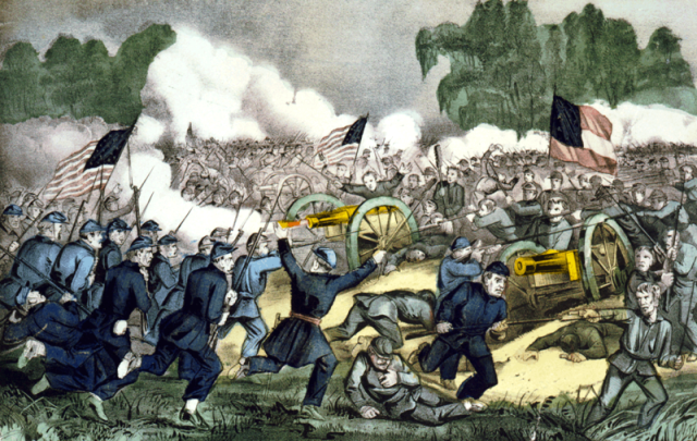
Although Gettysburg may be the best known city in this region, as it was the site of a pivotal Civil War battle – not to mention the subject of Lincoln’s Gettysburg Address – Harrisburg is the largest city and the state capital. It had first been settled in 1726 and was named after the original settler, John Harris. Harrisburg was pivotal spot during westward migration in the state, and it became one of the most industrialized cities in the northeast because of its large iron and steel plants as well as the nearby Pennsylvania Canal and Pennsylvania Railroad tracks.
GSP welcomes your suggestions, knowledge and guidance to genealogical resources within any area of Pennsylvania in which you live and do your own research. If you have information to share about local societies or repository resources, historical knowledge of the local area, or any other relevant genealogical information that could help people find their ancestors, please contact GSP so we can add this information to the County page. Thank You!
(Battle of Gettysburg by Currier and Ives, 3 July 1863. Image courtesy Library of Congress, ID – cph.3g02088)
(Thank you to Jane Benner for her contribution to this page!
Photo and Image Credits:
South Central Pennsylvania map image courtesy of www.digital-topo-maps.com
Top: Cumberland Valley Panorama, Wikimedia Commons, Photogrpaher Albrown3, 21 May 2008
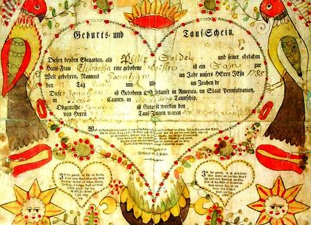
Center Right: A Pennsylvania German Fraktur Taufschein, 1788. Library of Congress, ID- ppmsc.00261
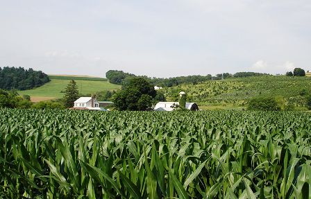
Center Left: York County, PA corn field and christmas tree farm. Wikimedia Commons, Photographer Skabat169, 30 June 2007)
